FPV UK is proud to introduce The Drone Map — a powerful new drone airspace & hazard map designed to make life easier for UK drone flyers.
Whether you’re using it on a desktop or installing it on your mobile device, The Drone Map is smooth and snappy.
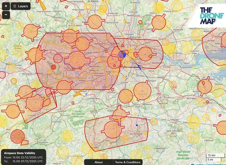
What Is The Drone Map?
The Drone Map is a modern, easy-to-use drone flight safety map that brings together critical drone flight safety information from multiple official sources into one clear interface. It helps you understand where you can fly – and, crucially, where you should not.
Fly Smart Today
Good flight safety starts with good information. The Drone Map helps you to understand risk, improves compliance, and supports responsible drone flying across the UK.
Drone pilots can explore the map today by visiting thedronemap.com and start planning smarter, safer flights.
Related
Discover more from sUAS News
Subscribe to get the latest posts sent to your email.